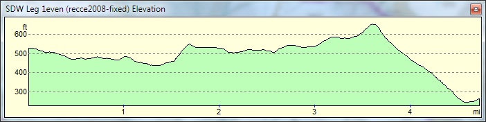
Leg 1 even years: Beachy Head to Jevington
Leg 2 even years: Jevington to Bo Peep

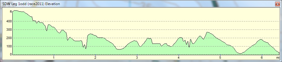
Leg 1 odd years: Beachy Head to Exceat
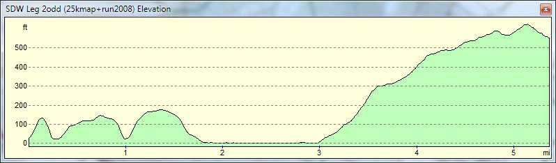
Leg 2 odd years: Exceat to Bo Peep
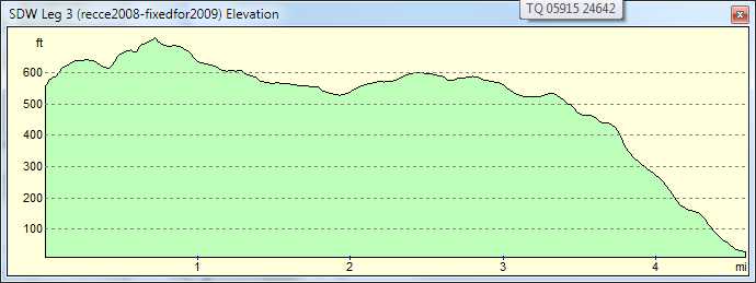
Leg 3: Bo Peep - A26 Itford Farm
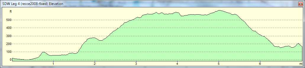
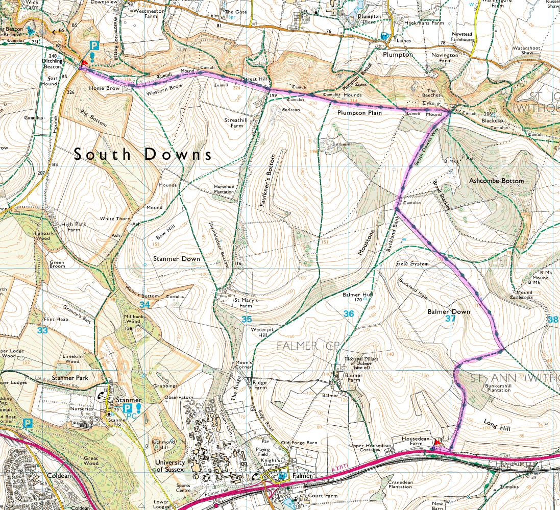
Leg 4: A26 Itford Farm - A27 Lay-by (Northside)
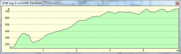
Leg 5: A27 Lay-by (Northside) - Ditchling Beacon
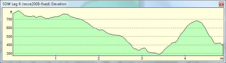
Leg 6: Ditchling Beacon - Saddlescombe
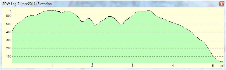
Leg 7: Saddlescombe - A283 Lay-by
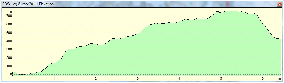
Leg 8: A283 Lay-by - Washington (South)
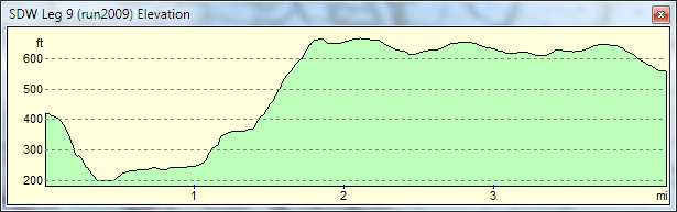
Leg 9: Washington (South) - Near Springhead Hill
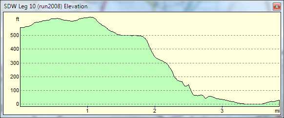
Leg 10: Near Springhead Hill - Houghton Lane
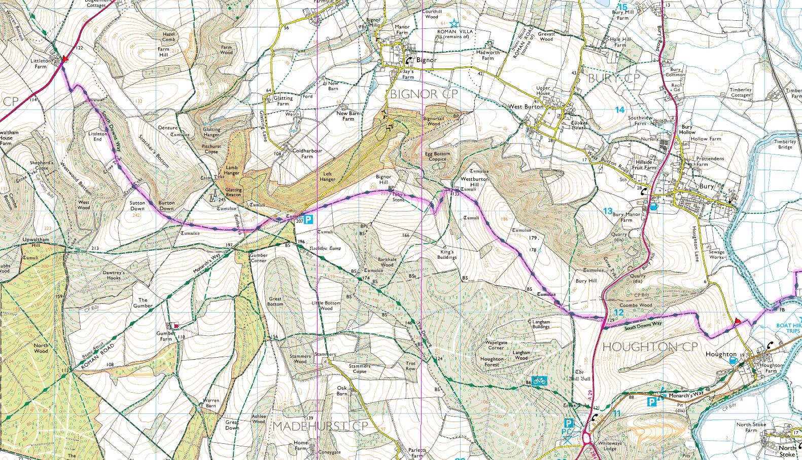
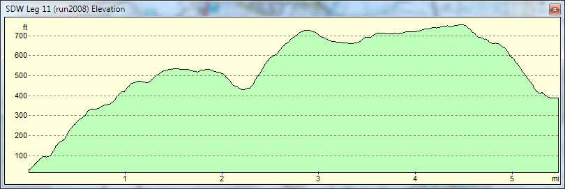
Leg 11: Houghton Lane - A285 Littleton Farm
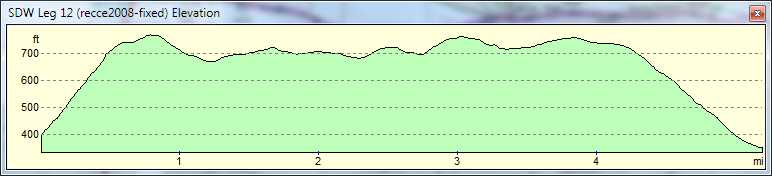
Leg 12: A285 Littleton Farm - A286 Nr. Hill Barn
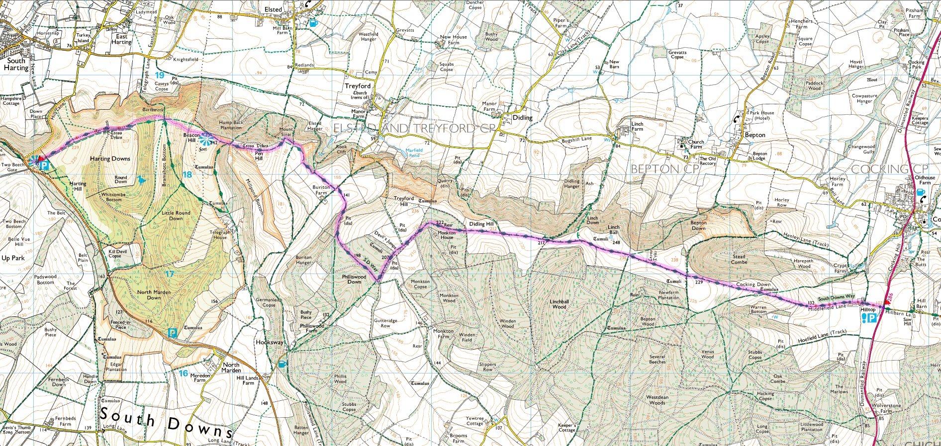
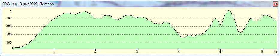
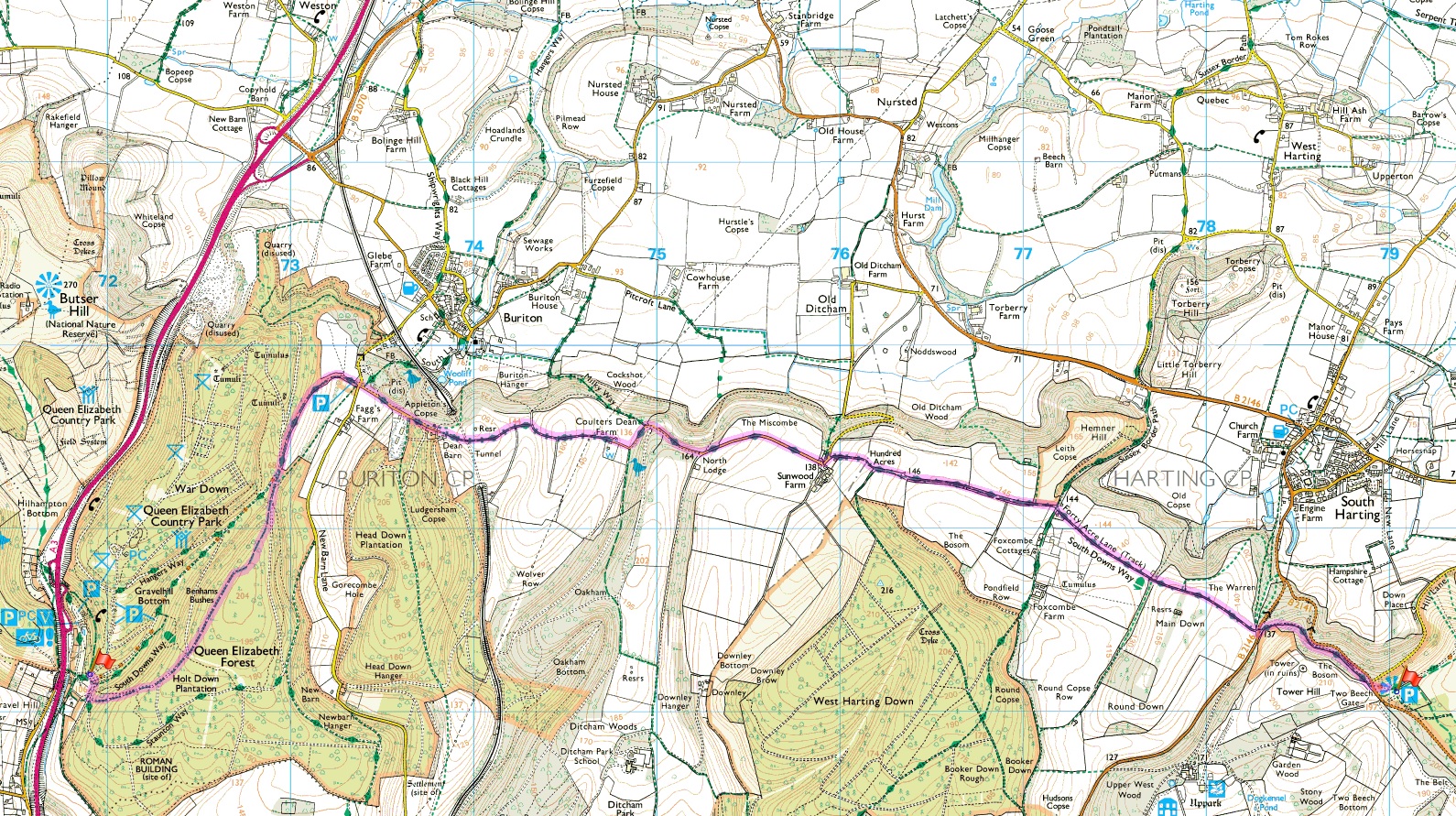
Leg 13: A286 Nr. Hill Barn - Harting Hill Car Park
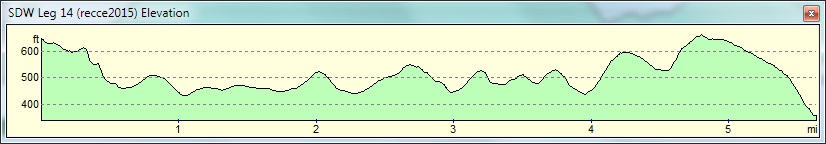
Leg 14: Harting Hill Car Park - Queen Elizabeth Country Park
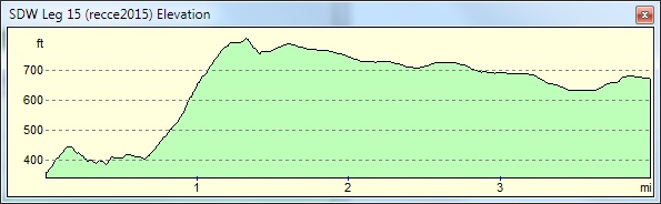
Leg 15: Queen Elizabeth Country Park - Sustainability Centre
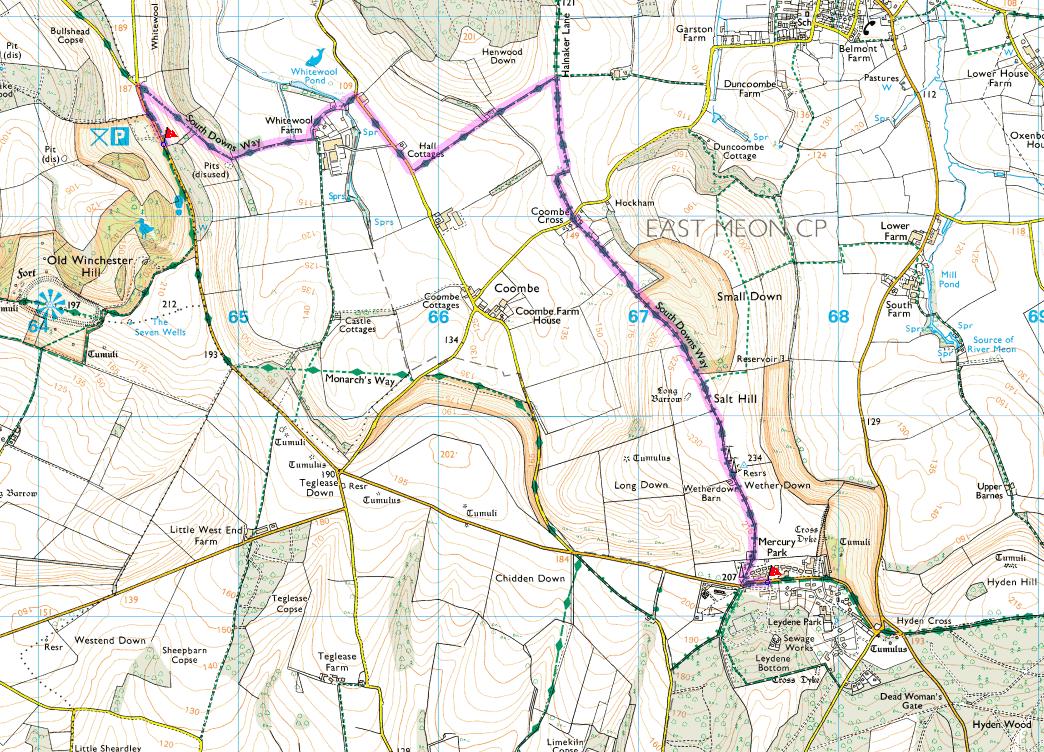
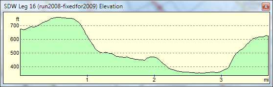
Leg 16: Sustainability Centre - Old Winchester Hill Car Park
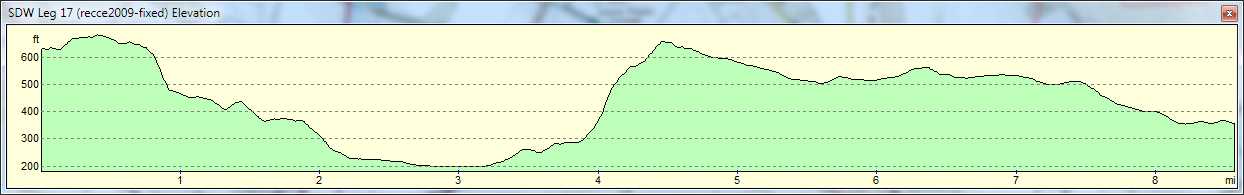
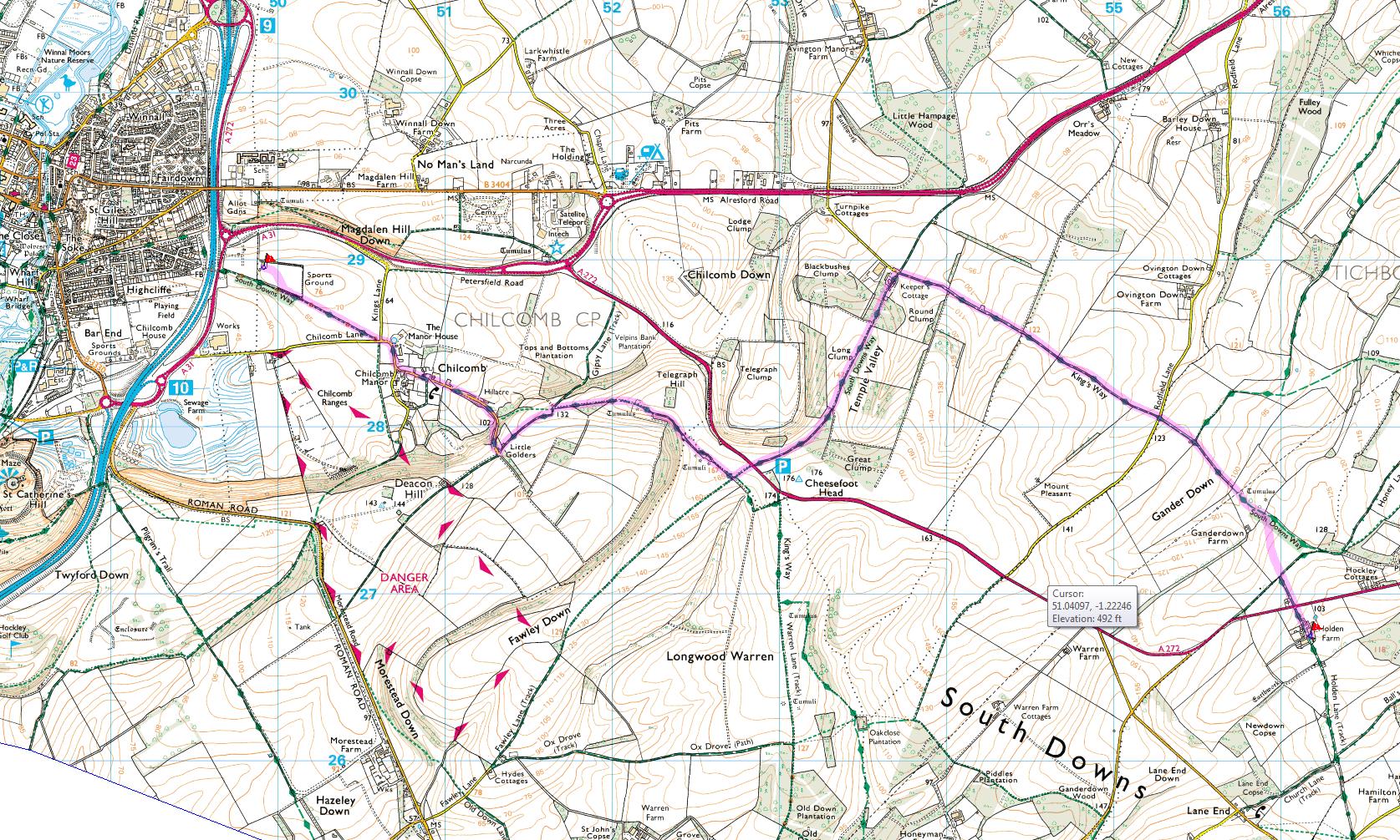
Leg 17: Old Winchester Hill Car Park - Holding Farm
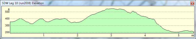
Leg 18: Holding Farm - Chilcomb Sports Ground
John at Bigg me uk - 26th Jan 2012