The route shown was last updated for 2018 to revert back to the Leg 7/8 changeover used in previous years. Note that parking is still at Botolphs, but the changeover is back as a 2 baton changover on the A283. I am unaware of any changes made since 2015 other than this so if there have been any, they will not be shown on this site.
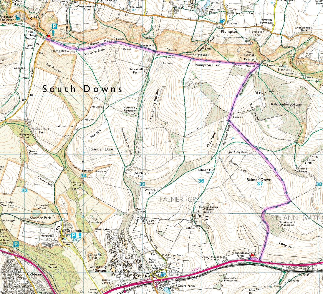
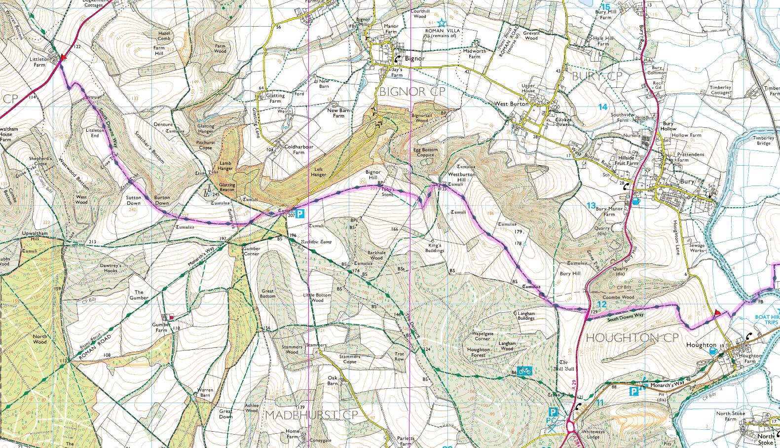
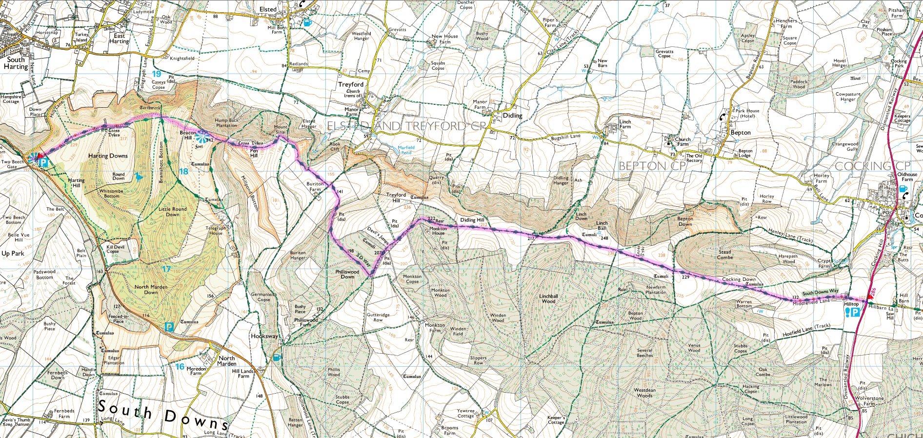
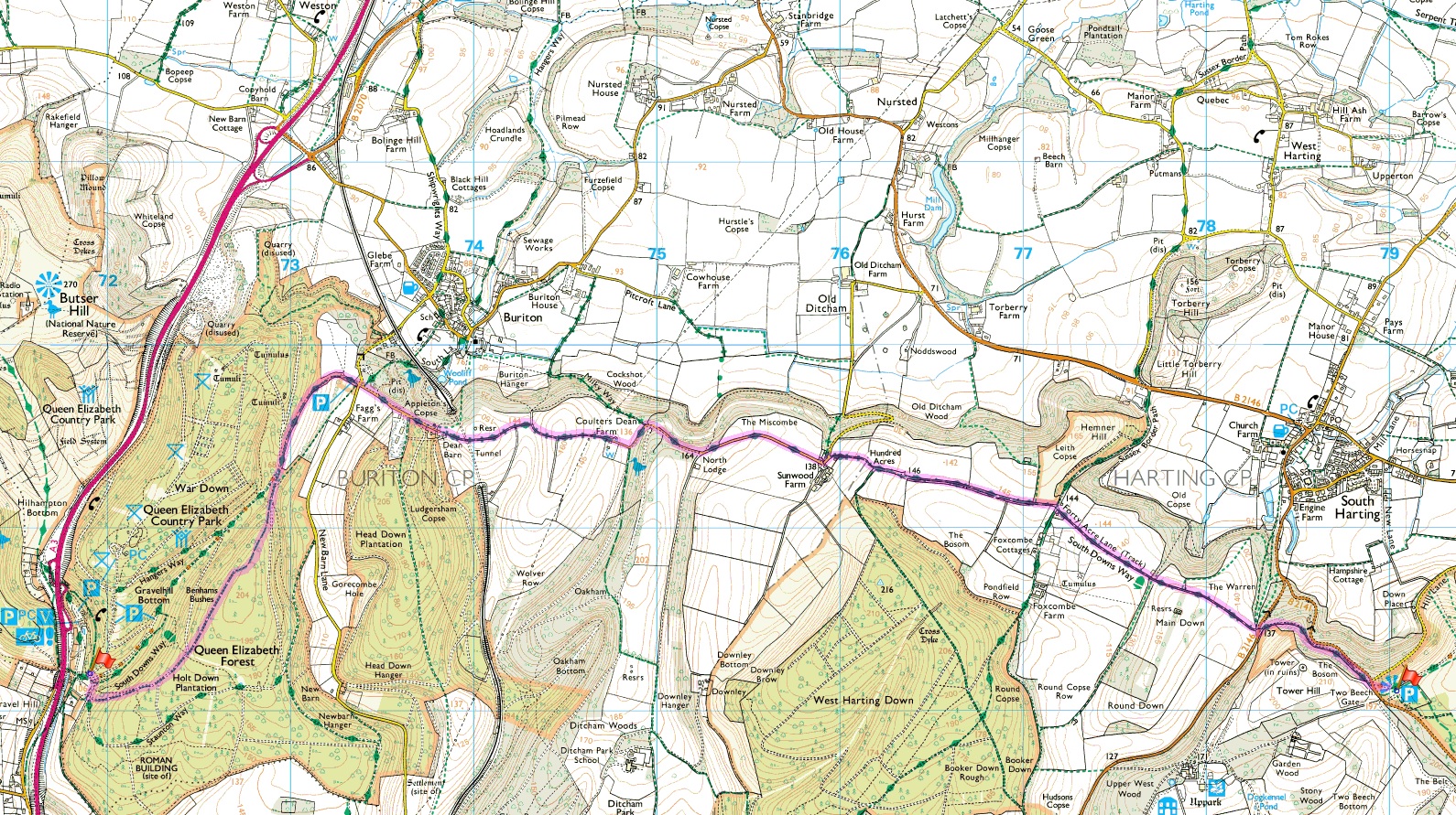
This page contains information which should help you recce and run the South Downs Way Relay race. For each leg you can view the leg on a 1:25,000 OS Map, download a Garmin Training Center course file, download a GPX file or view an aeriel picture using Google maps. Leg elevations can be found here.
The course files can be loaded into Garmin Training Center and then downloaded to Garmin devices such as the Forerunner 205, 305, 310XT1. and 910X watches which many people have. The newer 920XT, 935 and Fenix range can also be used but you will be better off using Garmin Basecamp to load the course onto the watch. This allows you to follow the course on your screen as you run. Other Garmin watches like the 405 and the 610 do not include the functionality to display a track on the screen so if you have one of these you are out of luck. If you do not have a Garmin you may be able to use the GPX file to do similar things with other devices such as the Motorola MotoActv.
The data used to create this information has been largely derived from data I was provided by people recce'ing the legs or from previous races. However, you should not use this data as a substitute for recce'ing your legs and do not assume they are going to be 100% accurate. I have not run all the legs myself to check but I have done my best to read the information available from the organisers.
If you find any mistakes please let me know so I can correct the legs. If you run one or more legs and obtain GPS tracks please let me have them so I can check and update what I have here. I can convert from tcx, gpx or other schemas so do not worry too much about the format.
The easiest way to get the data is to download the course file for the entire race rather than the individual legs you are running. You can then start your Garmin watch at the beginning of your leg and it will jump to the relevant section for your leg. Do this by downloading the All Legs as one file tcx file. This also has the advantage during the race that you can pass your watch from person to person without worrying about switching to the correct leg at the right time. The watch will automatically move the map to where you are.
If you do not know what to do with a course file, Don Powell put together a nice how too pdf file showing how to download install and use the course files with a Garmin Forerunner. Simply substitute the course filename with the one you download from here.
If you now use Garmin Express rather than the older ANT Agent software then you will not be able to use Garmin Training Center to load the data onto the 310XT and 910XT watches. Instead you will need to download these from Garmin Connect. You can find the 2017 course here on Garmin Connect
Right click and use "Save Target as...", "Save Link as..." or a similar option to save the gpx and tcx files on your local computer. Otherwise the raw XML will be displayed in your browser window. Right click and use "Open in New Window/Tab" on the maps and other links if you wish to keep this page open.
If you are having trouble importing the tcx files into Garmin Training Center
and downloaded using Internet Explorer it could be because you downloaded the
file and saved it as .xml rather than .tcx. Garmin Training
Center will only see and import the file if it has a .tcx extension.
In order to save it as .tcx in Internet Explorer, make sure the file
name ends .tcx and not .xml before you hit save. If the
"Save as type" option shows "XML Document"
change it to read "TCX File" or if this does not exist,
"All Files". If you save it as "XML
Document" it will be saved with both .tcx and .xml
and will be invisible in Training Center.
The same problem may exist when downloading .gpx files using Internet
Explorer. Use the same method above substituting .tcx with .gpx.
Alternatively, you can download using another browser like Firefox which does
not have this "feature" and will save the file correctly without changing
the file extension.
The rest of the information here describes the history of each leg and is purely to help me (or you) ensure they are up to date with the latest information.
Leg 1 (odd years) is taken from the race in 2011.
Updated 26/01/12.
Leg 1 (even years) is taken from a recce done in 2008.
Updated 21/04/10.
Leg 2 (odd years) has the first part drawn by hand using 1:25,000 OS maps
with the second half from Alfriston from the 2008 race which follows the same course.
Updated 12/05/09.
Leg 2 (even years) is taken from the race in 2008.
Updated 21/04/10.
Leg 3 is taken from a recce done in 2008 updated to use the new
bridge at Itford Farm.
Updated 12/05/09.
Leg 4 is taken from a recce done in 2008.
Updated 12/05/09.
Leg 5 is taken from the race in 2008.
Updated 12/05/09.
Leg 6 is taken from a recce in 2008.
Updated 12/05/09.
Leg 7 is taken from the race in 2011.
Updated 26/01/12.
Leg 8 is taken from the race in 2011.
Updated 26/01/12.
Leg 9 is taken from the race in 2009.
Updated 22/04/10.
Leg 10 is taken from the race in 2008.
Updated 12/05/09.
Leg 11 is taken from the race in 2008.
Updated 12/05/09.
Leg 12 is taken from a recce in 2008.
Updated 12/05/09.
Leg 13 is taken from a recce in 2011.
Updated 02/06/11.
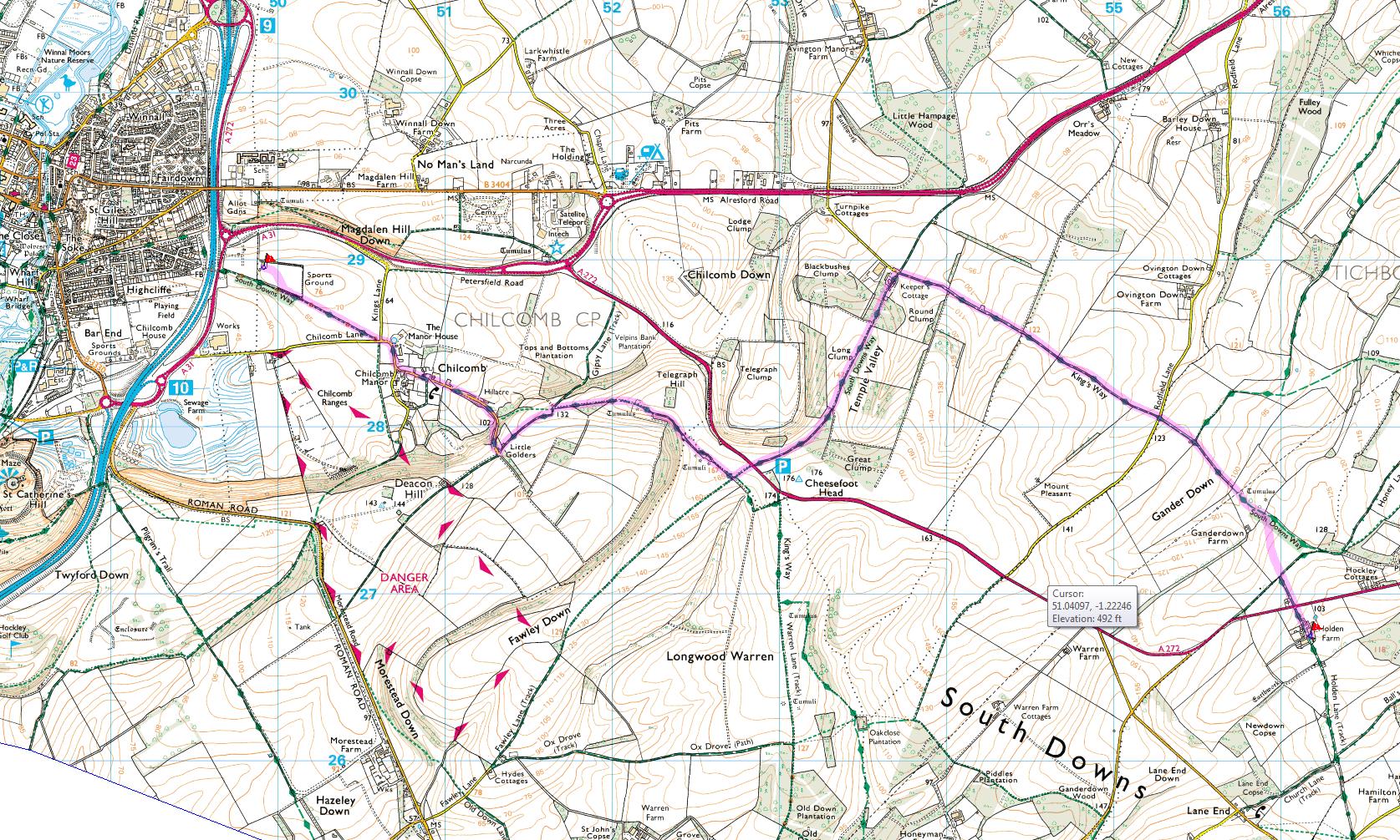
Leg 14 is taken from a recce in 2011 updated with new QECP route recced in 2015.
Updated 09/05/15.
Leg 15 is taken from a recce in 2011 updated with new QECP route recced in 2015.
Updated 09/05/15.
Leg 16 is taken from the race in 2008 updated due to a change
in the route of the South Downs Way at the end of the leg.
Updated 13/05/09.
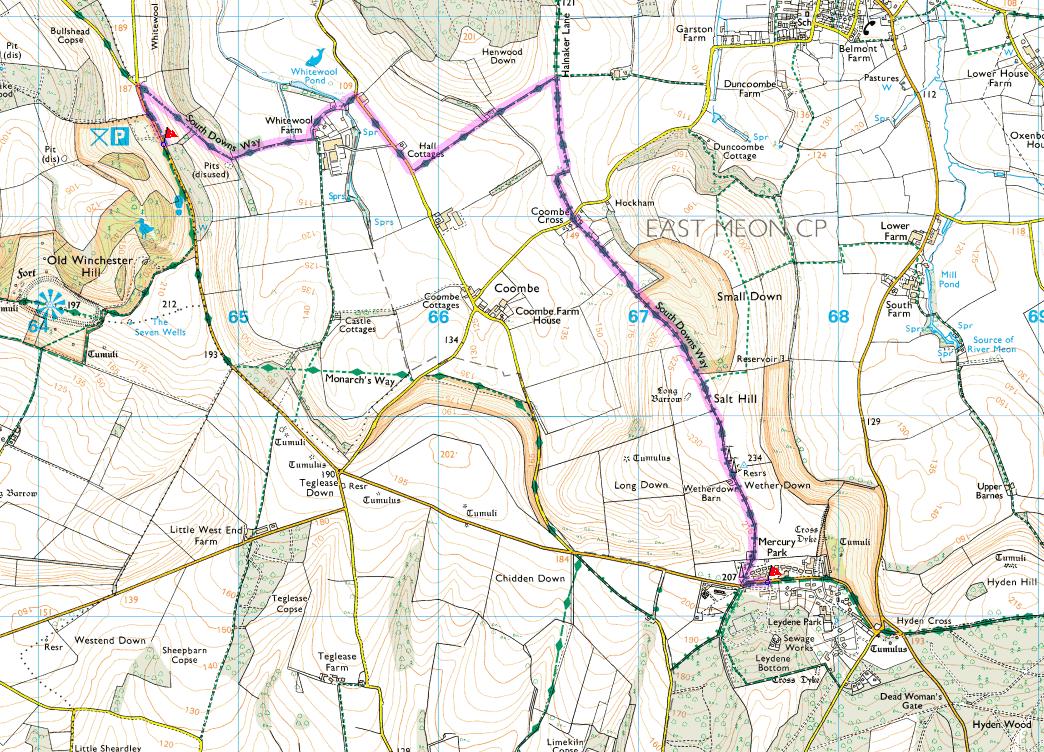
Leg 17 is taken from a recce in 2009 (includes 2009 SDW changes at
Old Winchester Hill and Beacon Hill).
Updated 25/05/09.
Leg 18 is taken from the race in 2008.
Updated 12/05/09.
All contains all legs joined together. The version number
on the file will allow you to see if this has been updated since you last
downloaded it since I will probably keep old copies.
Updated 26/01/12.
All legs may have been edited slightly to correct for obvious errors where runners went the wrong way and corrected themselves or got back onto the right path and to cover for underruns and overruns. Sometimes I have newer data but I can see the older data is as or more accurate. This is the case for leg 2 odd years where the first part is hand drawn, but I can see is as accurate as data from 2009 and 2011 which has other errors where runners made mistakes. This highlights the need to recce well!
1. In previous years I had problems downloading large tracks to my 310XT. The individual leg tracks were ok, but the full 18 leg track as one file would not download. It appears there was a limit to the size of the track that could be downloaded without error so I divided it into 2 chunks for 310XT users. I found reports of this in the garmin forums and Garmin seemed to acknowledge the problem. It appears that Garmin have fixed this now and after upgrading to the latest firmware (4.20) this is no longer a problem. If you experience trouble downloading the full track but the individual legs download ok then ensure you have the latest watch firmware (4.20 or newer, I had trouble with 3.70) and that you are using the latest Garmin ANT Agent, Communicator Plugin and version of Training Center depending on exacly how you download the file. Contact me if you are still having trouble and I will see if I can help.
John at Bigg me uk - 26th May 2018